The Turin Beatus Map of the World
Annotation
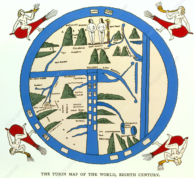
Before the modern age, maps offered more than just an objective, geographical survey. Often, as is the case with this world map from the 12th century, they also conveyed a set of stories that shaped the worldview of its viewers. This map, for instance, sought to convey allegorical, religious, and geographic information all at once. It located Adam and Eve, the world's first humans according to Judeo-Christian texts, in the continent of Asia as it surrounded the known world with a single ocean whose currents and storms were caused by the four windblowers in the corners of the map.
This source is a part of the Analyzing Maps methods module.
Credits
Science Photo Library [https://www.sciencephoto.com/media/159320/view/coloured-8th-century-turin-map-of-the-world], My Old Maps [http://www.myoldmaps.com/early-medieval-monographs/20715-turin-beatus-map.pdf].