Browse Website Reviews
Discover quality websites on a range of topics and time periods. If a website link is no longer active, consult this guide to website URL paths for tips on locating the original resource.
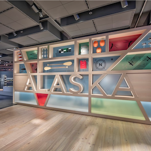
Anchorage Museum at Rasmuson Center
This website provides links to lesson plans based on exhibits, as well as images from the museum’s collection that may not otherwise be available to visitors.
UM Museum of Anthropological Archaeology Image Database
What makes this site useful is its open accessibility to see the results of archaeological digs and excavations.
ORBIS: The Stanford Geospatial Network Model of the Roman World
This is a useful tool for educators to model how the Roman empire operated, as well as what those operations may have looked like in practice.
The People’s Map of Global China
This website maps the international activities of Chinese businesses or government affairs, to create an idea of “Global China.”
History21
The most meaningful goal of this site is its emphasis on epistemology, and students learning how to think historically.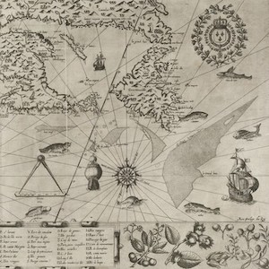
French Renaissance Paleography
This website is a compilation of manuscripts from France through 1300 to 1700, which come from a variety of sources, such as legal documents, contracts, or calligraphy books.
Native Land
It is a good place to start learning about knowledge generation and how indigenous groups and settlers can come together to document their histories.
Travels Through Greco-Roman Antiquity
This website is an excellent primer into ancient Greek and Roman places and events, with references to other sources and maps that may aid in reconstructions of the area.
ClioVis
It is useful for classrooms, where students and instructors can use it to display ideas, events, and other important information from/for a lesson.
Zooniverse
Zooniverse is a platform where researchers can build projects and solicit the help of volunteers to process data.
African Activist Archive
This archive serves as a general reference place for primary sources, as well as a starting point for focused research projects into specific organizations, as well as examinations on how activism is documented.
Saving Slave Houses
The author [discusses things] such as preservation and documentation, to show the relevance and impact of work that deals with the history of enslavement.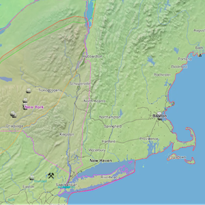
Running Reality
This site is great for teaching students about geographical analysis and how historical events affect the physical environment and territories of people and groups.
Women's Worlds in Qajar Iran
One of the key features of the website are the digital collections related to women’s lives during the Qajar period with sources and collections from both private family collections as well as archival holdings.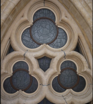
Paris Past and Present
This site works as a supplement to classroom discussions about urban architecture in medieval France, or even for [those] who want to see visual reconstructions of the historical buildings.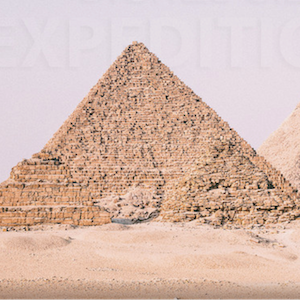
Digital Giza: The Giza Project at Harvard University
The website itself has 3D reconstructions...a glossary which gives brief descriptions of people and places, terms, and acronyms... [and links to] NEH lesson plans, Egyptology videos, blogs, and other related sources.
Historic Government Publications from World War II
Easy to use, chockful of useful content, and easy to access even when offline, Historic Government Publications from World War II shows that repositories do not need to be overly complicated to achieve good things.
The Abolition of Slavery Project
By breaking up the site into different areas of focus, such as enslavement itself and abolition, it allows itself to be easily navigable by students and scholars alike.
Chinese Text Project
largest database of pre-modern Chinese text digitally available...[which] focuses specifically on pre-Qin and Han dynasty works, as well as post-Han dynasty texts.